top of page
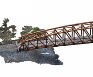
Engineering - Using advanced drone technology, allows seeing our property from a vastly new perspective. 3D point cloud modeling, ortho-rectified images, thermal Infrared scans, and high-resolution geo-referenced photos to provide unique views of any site. With our high-resolution aerial photography and advanced photogrammetry, clients can visualize their project without even needing to step foot on site. Not only is drone engineering safer, faster, and more cost-effective, it provides accurate and abundant data when compared to other traditional engineering techniques.


Bridge Construction plan Construction Monitor Plant Modelling Construction Change over time
bottom of page